Thank you for Subscribing to Agri Business Review Weekly Brief
Factors Influencing Crop Insurance Premiums
Integrating satellite and aerial imagery into crop insurance services is transforming the agricultural industry.

By
Agri Business Review | Thursday, February 13, 2025
Stay ahead of the industry with exclusive feature stories on the top companies, expert insights and the latest news delivered straight to your inbox. Subscribe today.
Fremont, CA: Technology boosts productivity, manages risks, and ensures sustainability in modern agriculture. One of the most impactful advancements has been the integration of satellite and aerial imagery into crop insurance services. The technology has revolutionized how insurers and farmers assess risk, monitor crop health, and adapt to environmental changes. By offering real-time, precise data, satellite, and aerial imagery transform the crop insurance industry, providing economic and ecological advantages. A key benefit is the ability to accurately assess crop conditions, ensuring more precise loss evaluations and payout claims.
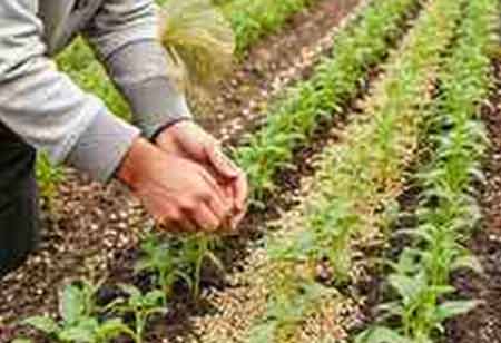
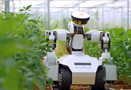
The process has been time-consuming and labor-intensive, requiring field agents to inspect large areas of farmland manually. With the advent of satellite and aerial imagery, crop monitoring has become more efficient and precise. High-resolution images captured from satellites and drones provide detailed insights into crop health by measuring various factors such as plant biomass, chlorophyll levels, and moisture content. These images help insurers detect early signs of stress from drought, pests, diseases, or nutrient deficiencies, allowing for proactive measures to minimize losses.
Satellite imagery enables rapid and accurate assessments, reducing the time needed to process insurance claims and ensuring farmers receive timely compensation. Fraudulent claims in crop insurance can be a significant challenge for insurers, leading to higher premiums and financial instability within the system. It reduces the potential for human error, manipulation, or false reporting. It helps insurers maintain integrity within the crop insurance system and fosters trust between farmers and insurers by ensuring transparency in the claims process.
Satellite and aerial imagery contribute significantly to better risk management for farmers and insurers. By continuously monitoring vast agricultural areas, this technology enables early detection of potential risks such as extreme weather conditions, pest infestations, and water stress. With this data, insurers can more accurately price premiums based on real-time information about a farm's risk profile, leading to fairer pricing models for farmers. It helps farmers minimize potential losses. Early detection of issues allows for timely interventions such as adjusting irrigation, applying targeted pesticides, or implementing pest control measures.
Crop insurance services must adapt to increasingly volatile weather patterns. Satellite and aerial imagery are essential for managing the risks associated with climate change. The technology offers a bird' s-eye view of how crops respond to environmental stressors such as drought, floods, and extreme heat. It can improve crop yields and reduce the need for large insurance payouts, benefiting the farmer and the insurer. Insurers can adjust their models to account for these changes, providing more accurate coverage options for farmers. The data-driven approach ensures that insurance policies are better suited to the evolving needs of agriculture in a changing climate.